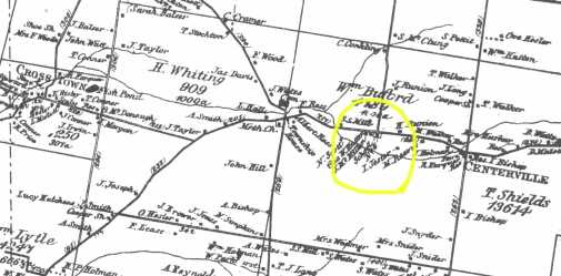
1876 Atlas of Brown County
This is a portion from the Atlas of 1876 for Brown County, showing (within the yellow circle) the approximate location of Noah Conover's land he purchased in 1868.
At the left is Crosstown.
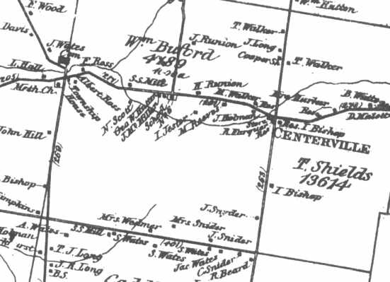
This is a closer view of the same area circled above.
Note the properties of I Jester, Geo Hutton, the Sniders, and H Runion.
Scholl No 6 appears here as well.
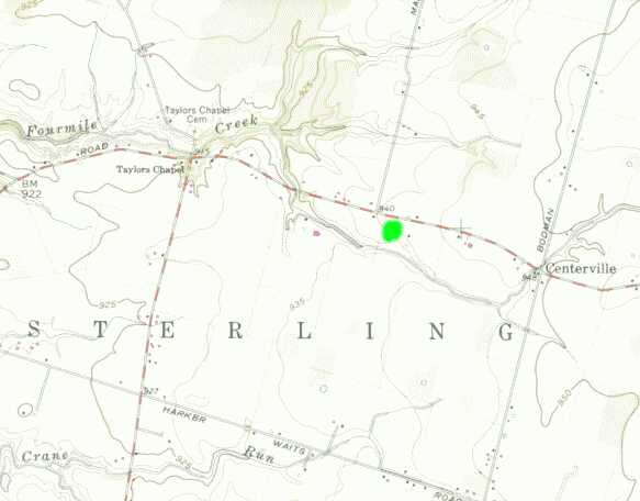
Modern topographic map of the same area as above.
The green dot marks the area where Noah Conover and his family owned land in Brown County on the Buford Survey, until 1872 or so.